Ko
Menu
English
Arabic
Brazil
French
German
Italian
Russian
Simplified China
Traditional China
Spanish
Turkey
India
Vietnam
Japanese
Korean
앱 정보
연락처
Ko
English
Arabic
Brazil
French
German
Italian
Russian
Simplified China
Traditional China
Spanish
Turkey
India
Vietnam
Japanese
Korean
This section is not available yet
홈
지도
오스트레일리아
Tamworth
섹션
최고 장소
엔터테인먼트
도서관
공원
수영장
관광 명소
관광 명소
교회
기념물
박물관
전망대
비즈니스
숙박
아파트
캠핑
게스트하우스
호텔
모텔
상점
의류점
컴퓨터 상점
백화점
쇼핑몰
슈퍼마켓
건강
병원
식품
카페
패스트푸드
펍
교육
전문대학교
유치원
학교
교통
공항
주유소
기차역
금융
은행
우체국
게스트하우스
Paradise Tourist Park Hotel
575 Peel St, Tamworth NSW 2340, 호주, GPS: -31.100012,150.93687
Plumes on the Green
Hillvue NSW, 호주, GPS: -31.12754,150.92105
공원
Gunns Park
2.5
Quality Hotel Powerhouse Tamworth
3.2
248 Armidale Rd (East St), Tamworth NSW 2340, 호주, GPS: -31.098015,150.94032
신용카드
+
more
공항
Goonoo Goonoo Airport
0.5
Tamworth Regional Airport
2.0
관광 명소
Tamworth Regional Entertainment Centre
Greg Norman Drive, Hillvue NSW 2340, 호주, GPS: -31.129429,150.9185
Tamworth Miniature Railway
2.0
교회
St Peters
2.0
Tamworth Southside Uniting Church
2.5
기념물
War Memorial
2.0
Truck Drivers Memorial
2.5
기차역
Tamworth
2.0
Tamworth Shoppingworld
3.4
61 Barnes Street, Taminda NSW 2340, 호주, GPS: -31.092495,150.91049
신용카드
+
more
도서관
Tamworth DDS
호주, GPS: -31.108381,150.90828
Tamworth Municipal Library
2.0
모텔
Ibis Styles Tamworth
2.5
Tamworth Lodge Motel
2.5
박물관
Tamworth Powerstation Museum
216 Peel St, Tamworth NSW 2340, 호주, GPS: -31.087408,150.92686
신용카드
+
more
백화점
Kmart
3.2
432-452 Peel St, Tamworth NSW 2340, 호주, GPS: -31.092167,150.93282
신용카드
+
more
병원
Tamara Private Hospital
Tamworth NSW, 호주, GPS: -31.077435,150.92175
Tamworth Rural Referral Hospital
1.0
쇼핑몰
Tamworth Shopping World
1.5
Centrepoint Tamworth
3.5
374 Peel St, Tamworth NSW 2340, 호주, GPS: -31.090622,150.93065
신용카드
+
more
수영장
South and West Tamworth War Memorial Swimming Pool
1.5
슈퍼마켓
Woolworths
3.2
Tamworth NSW 2340, 호주, GPS: -31.09659,150.93631
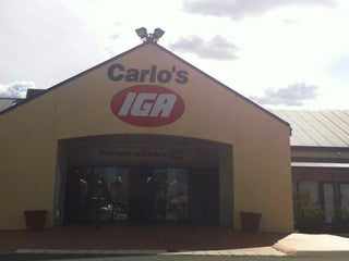
Carlo's IGA Plus Liquor Calala
3.3
10 Campbell Road, Calala NSW 2340, 호주, GPS: -31.12606,150.94127
신용카드
+
more
아파트
The Roseville Apartments
Gipps Street (Ebsworth Street), West Tamworth NSW 2340, 호주, GPS: -31.095482,150.92395
Bunkhouse Group and Family Accommodation
2.5
우체국
Nemingha Post And News
2.0
West Tamworth Post Office
2.5
유치원
Goodstart Early Learning
1.0
은행
Commonwealth Bank
Bridge St, West Tamworth NSW, 호주, GPS: -31.09316,150.91951
의류점
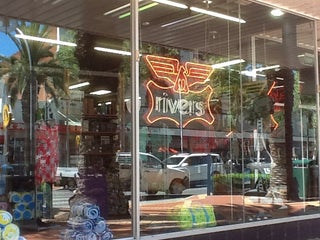
Rivers Clearance Store
292 Peel St, Tamworth NSW 2340, 호주, GPS: -31.088953,150.92865
신용카드
+
more
전망대
Green Corps Lookout
2.0
Long Gully Lookout
1.0
전문대학교
Tamworth TAFE
1.0
주유소
Coles Express Tamworth
2.5
Mobil
1.0
카페
The Heights Cafe
$
91 The Heights (The Boulevard), Tamworth NSW 2340, 호주, GPS: -31.1253,150.90771
가격
+
more
North Tamworth Express
1.5
coffee shop
캠핑
Oxley Lookout
1.0
Tamworth Airport Rest Area
0.5
컴퓨터 상점
Technitune
1.0
패스트푸드
Subway
3.2
$
279A Marius St. (at Roderick St.), Tamworth NSW 2340, 호주, GPS: -31.09585,150.93716
가격
야외 좌석
+
more
Subway
3.1
$
호주, GPS: -31.126251,150.92342
가격
+
more
펍
West Tamworth League Club
3.3
58 Phillip St., West Tamworth NSW 2340, 호주, GPS: -31.10238,150.9171
Longyard Hotel
3.8
$$
The Ringers Rd, Tamworth NSW 2340, 호주, GPS: -31.127174,150.92285
가격
예약
신용카드
야외 좌석
+
more
학교
St Mary's School
2.5
Parry School
2.5
호텔
Longyard Hotel
2.0
가격
예약
신용카드
야외 좌석
+
more
Quality Hotel Powerhouse
2.5
Show on map
Show list
MAPS.ME
휴대하세요
앱을 다운로드해 더 넓은 세상과 만나세요
MAPS.ME 앱 열기
웹 버전 사용